
By using this site, you agree to observe and follow all park rules and regulations and assume all personal liability.
A couple of things before you experience one of our Tree Trails:
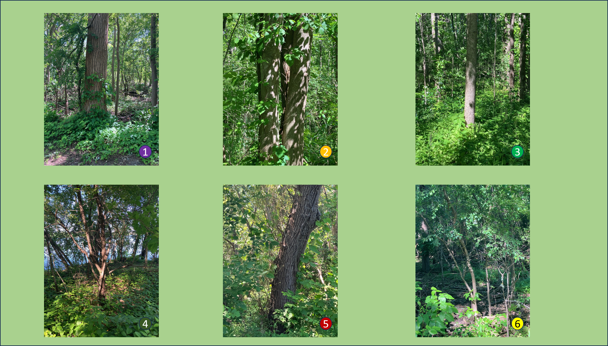
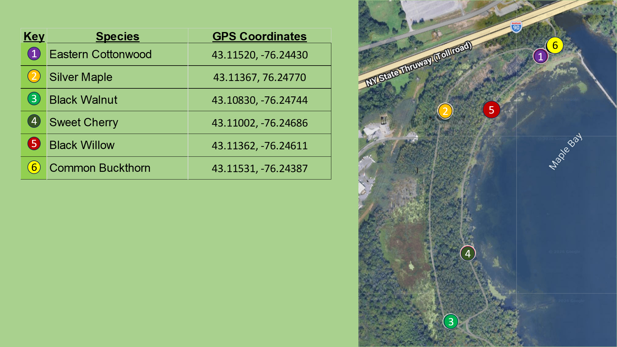
First, if you have never used GPS Coordinates to find something as precise as a single tree, please understand that these coordinates will get you close, but not always shoulder to shoulder with the tree you are looking for…your “final search” is part of the experience of being in the trees…use the pictures below the map as an added guide.
Second, let us know through the “Contact Us” button about your experience.
Onondaga Lake Park - West Shore Trail
PARK WEBSITE: onondagacountyparks.com/parks/onondaga-lake-park/
This stretch of the West Shore Trail sits on land that was heavily reshaped for the railroad corridor that once ran along this side of Onondaga Lake. Unlike the east and north shores—where the salt works, hotels, and amusement attractions were concentrated—this side of the lake was historically a quiet, swampy margin, later filled and leveled for rail and park development. The original 1890s rail line hugged the shoreline much more closely, but subsequent filling pushed the lake edge outward, leaving today’s rail bed slightly farther inland. All of this grading and fill created a flat, uniform, poorly drained substrate that strongly favors disturbance‑tolerant floodplain pioneers, which is why Eastern Cottonwood now dominates almost to the exclusion of everything else, with Silver Maple in the wetter pockets. Small rises along the old rail berm support the few additional species you see—Black Walnut, Sweet Cherry, and invasive Buckthorn—because the soils there are slightly higher and better drained. The recent removal of all ash trees due to emerald ash borer further simplified the canopy, and the open, moist conditions now allow poison ivy to thrive. What remains is a young, post‑industrial floodplain forest shaped more by past land use than by natural succession.
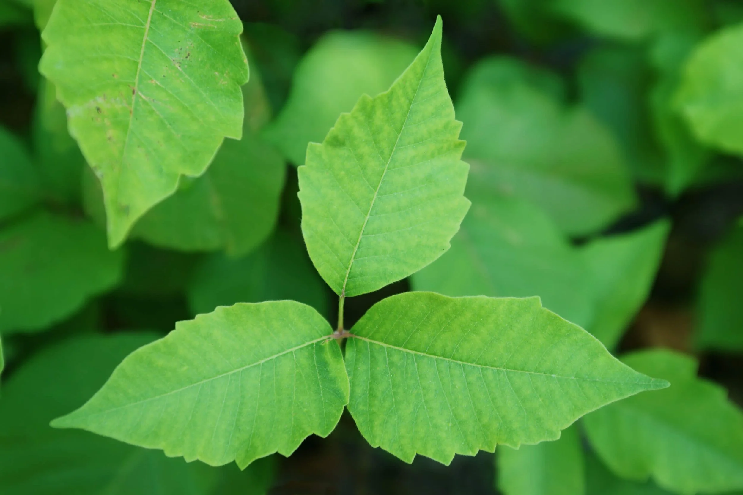
There is a lot of Poison Ivy throughout this area, so stay on the trails. REMEMBER: “Leaves of three, let it be”